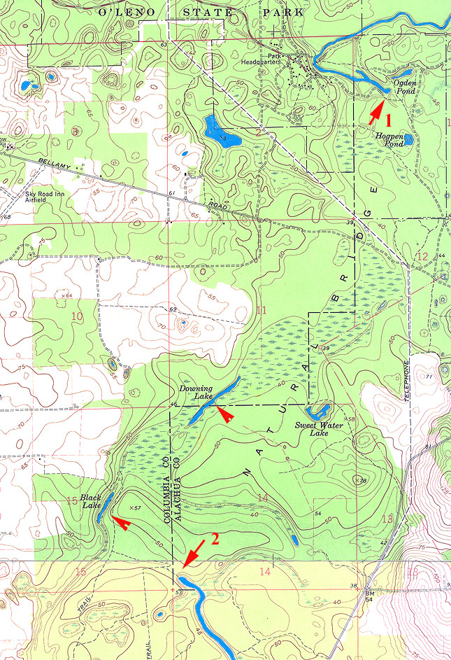
This is a composite of parts of two topographic quadrangles (Mikesville
and High Springs, Fl) showing the course of the Santa Fe River. The river
sinks in O'Leno State Park (arrow #1). From there it travels underground
in caves and passageways to resurface at River Rise near the bottom of
the map (arrow #2). Downing and Black Lakes (un-numbered arrows)are parts
of the river's underground course where the roof of the passageways have
collapsed, exposing the river briefly.
Back to Karst features