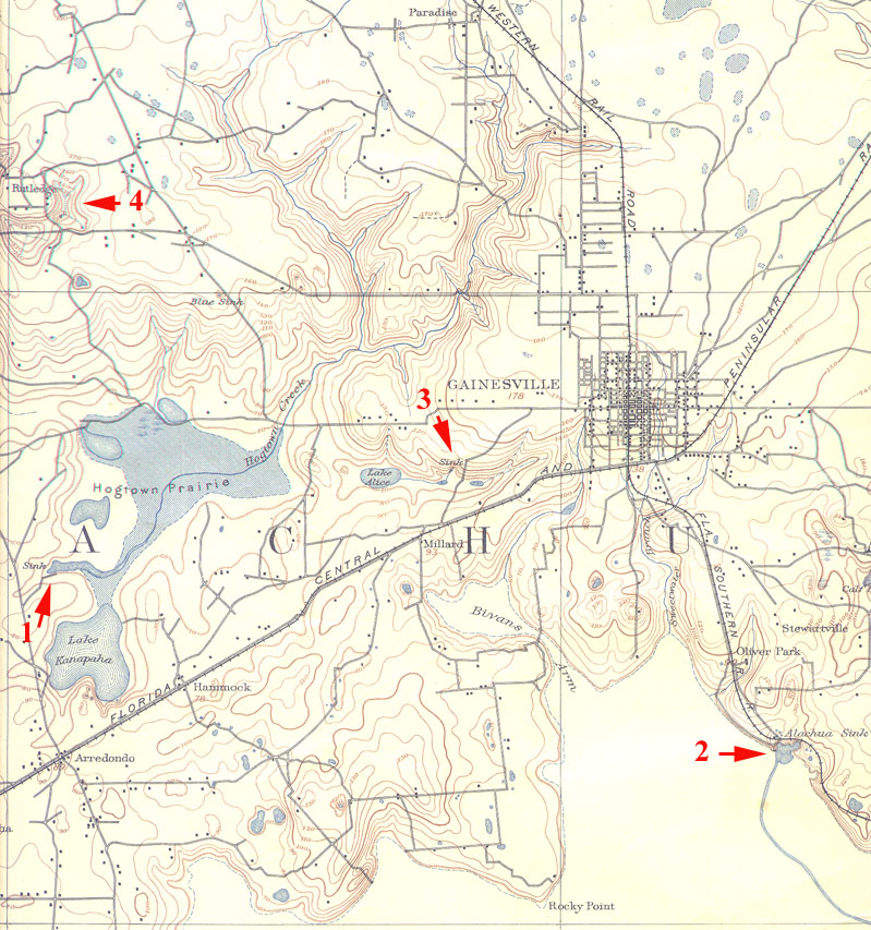
This is a segment of the USGS Arredondo, Fl 1:62500 15 minute Quadrangle.
It was surveyed in 1890 and published in March 1894. As you can see,
there have been some major changes in the Gainesville area in the last
century! The red arrows highlight four examples of disappearing streams.
The largest of these (#1) is a sink in Hogtown Prairie wherein disappears
Hogtown Creek. Arrow #2 marks Alachua Sink a major sink at the northern
edge of Payne's Prairie. The blue line that runs southeast from the
sink is Prairie Creek which carries water from Newnan's Lake (off this
map to the northeast) into the sink. Water from numerous creeks that drain
the edge of Payne's Prairie (note Bivan's Arm and Sweetwater branch
in the center near the bottom) also empty into Alachua Sink. #3 is Lake
Alice and an unnamed small creek near it. They both disappear into sinkholes.
#4 represents several stream to sink features that drain a closed solution
basin.
Back to karst features